Plot
3D Plot
Summit Evolution is an operational system on computer used to produce line mapping from the obtained aerial photograph and satellite imagery conveniently, it can create 3-dimensioned image rapidly with high quality. Moreover, it is able to arrange reproduction in various forms which are convenient to operate, besides the data can be linked to MATCH-T program of INPHO DTM easily and rapidly as it is able to support data in various forms such as PATB, Albany, Aerosys and BINGO. Furthermore, there is current development to be compatible with other programs too. Apart from good software, the operation requires other equipment such as 3D monitor, 3D signal-transmitted box, 3D glasses and 3D mouse which can render perfect function of this program, during functioning, the program can use pictorial information in various forms such as TIF, JPG and we can transform them to SMTI form in Summit Evolution program which is very convenient and very rapid in terms of working.
Summit Evolution and AutoCAD Map 3D

Map Editor
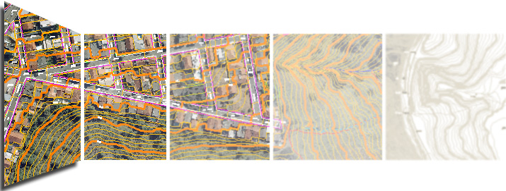
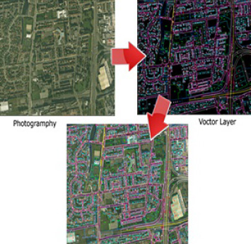
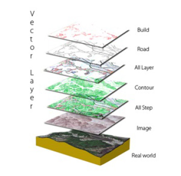
AutoCAD Map 3D is the program that able to access to Geographic Information System (GIS) and make perfect line mapping in order to support planning, designing and managing information efficiently. Due to the various functions of this program as well as equipment and instruction set that can cover its operation comprehensively and able to develop to enhance functional capacity too. During operation, Line Mapping Section shall use Summit Evolution program concurrently with AutoCAD Map 3D program in order to access data in 3D form according to the actual height of terrain such as roads, railways, buildings, houses, rivers, streams, canal, fences, slopes, plants zone, other zones, symbols of things (signs, forest, types of trees) and contour lines as the two programs shall display results of input information concurrently.
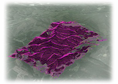
3D Plotting Layer
3D Plotting All Layer
The actual operation requires actual walkthrough survey map and input information by scanning as reference in AutoCAD Map 3D program which can render correct and rapid work. Information of line mapping can be stored in various forms such as *.dwg, *.dxf, *.dws *.dwt or transformed to be compatible with other programs such as *.sdf, *.e00, *.shp, *.gml, *.xlm, *.gz, *.mif, *.tab, *.dgn, *.sqlite, *.html etc.
3D Plotting Layer
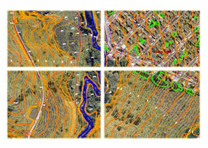
3D Plotting All Layer