
Since PASCO's establishment, PASCO has been producing various maps used by utilizing aerial photogrammetry.
In addition, PASCO provides support for various types of surveys and plans related to maps used for planning and design of social infrastructure.Integrated GIS (Geographic Information System) is a concept of sharing spatial information among all GIS users or specific users within the agency, and using the same thing to reduce duplication investment and improve efficiency of operations.
PASCO considers spatial data to be an information asset of the government, and believes that integrated GIS will be used by various fields and various users, thereby contributing to the efficiency of administrative affairs, reduction of duplicate investment, and improvement of community service.The important thing in the evaluation of fixed assets is the "logicality", "clarity" and "transparency" of the evaluation.
PASCO fully leverages the know-how accumulated over many years, and supports the property tax services for local government such as mapping, evaluation consulting and various research services.
Roads and bridges that support our lives can be said to be an important asset that will be maintained and improved as a social infrastructure and will be left behind in the future.
PASCO supports the development and maintenance of social infrastructure in a new era with the technologies accumulated through many years of surveying work and planning work.Since PASCO's establishment in 1953, by carrying out Aerial Photogrammetry PASCO is engaged in the production and updating of various maps for public sector such as Basic map for city planning and various maps and ledgers for road maintenance,water supply / sewerage maintenance, etc.
We carry out high-accuracy public surveying and actively incorporate the latest technology, and support local government operations widely with spatial information technology related to map.
About data processing ⇒ Our Service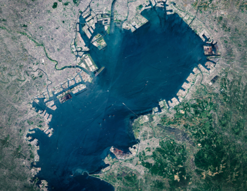
PASCO produces topographic maps and basic maps based on surveys and measurements by aircraft.
We perform photography and mapping according to public surveying including basic maps used in government offices, local governments and topographic maps used for design and planing.By carrying out aerial photogrammetry, PASCO supports a wide range of works, such as making maps, providing topographic analysis and surveys (rivers, erosion control, beaches, etc.), city planning, route planning (roads, railways, etc.) and vegetation surveys (forests, agriculture, lakes, etc.).
The service will be mainly in Japan, but data processing after measurement will be partially available.
About data processing ⇒ Our Service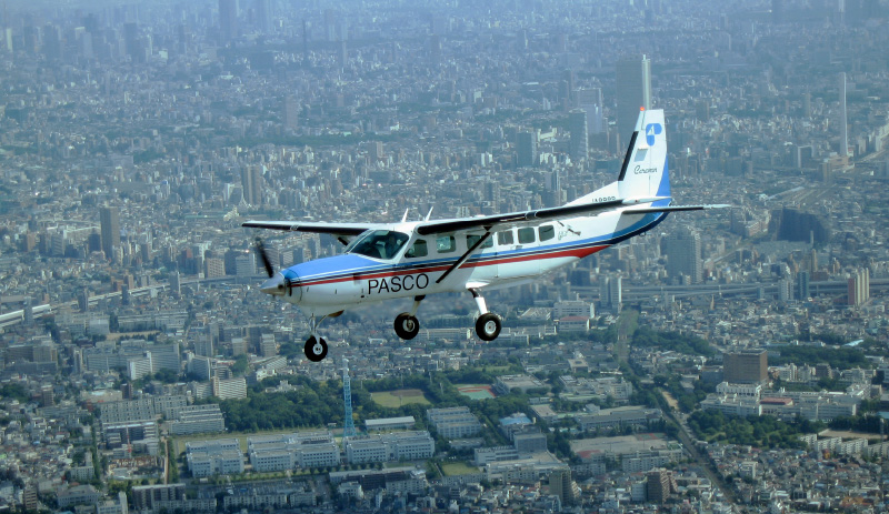
We measure 3D information of ground surface and features (trees and buildings) from the aircraft and the ground with high density and accuracy, and obtain 3D data of topography and features such as urban space and roads.
The created data can be used in various fields such as the field of imaging, architectural design, and automatic driving.Aviation laser measurement is a technology that acquires three-dimensional (3D) point cloud data (X, Y, Z), and is used when creating Digital Surface Model (DSM), which is one of the terrain representation methods.
This data is used in a wide range of fields such as "disaster prevention", "road management", "sabo ", "forest management", "agriculture", "city planning" and "river management".
The service will be mainly in Japan, but data processing after measurement will be partially available.
About data processing ⇒ Our Service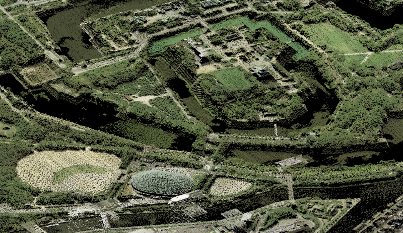
PASCO conducted joint research with Amuse One Self Co., Ltd. in “Innovative River Management Project” led by Japan's Ministry of Land, Infrastructure, Transport and Tourism.
PASCO carries out measurement services and equipment sales using a green laser scanner that can measure the topography of land and the bottom of water.
The service will be mainly in Japan, but please contact us if you are interested in this service.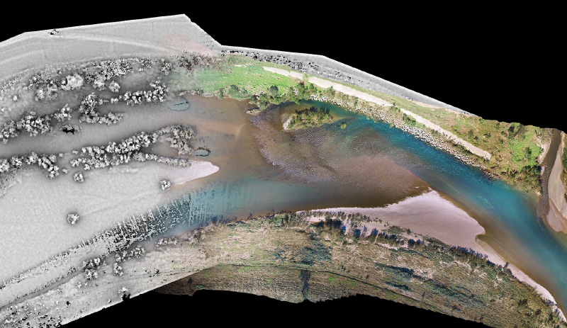
The precise three-dimensional measurement of roads and roadsides using MMS (Mobil Mapping System) can be applied to three-dimensional measurement of river dikes, and is also used in the construction of road ledgers for local governments and dynamic maps for automatic driving.
In addition, the survey of road surface conditions (ruts, cracks, flatness, etc.) using road surface measurement vehicles are used for maintenance of pavements such as roads, airports, and test courses of automobiles, and also for supporting overseas road maintenance and management.PASCO utilizes MMS (Mobile Mapping System) to improve the efficiency and sophistication of road maintenance and management work, to optimize the life cycle cost of social infrastructure, and to prolong social infrastructure.
We also support the creation of dynamic maps which are necessary for automatic driving.
About MMS ⇒ Our Service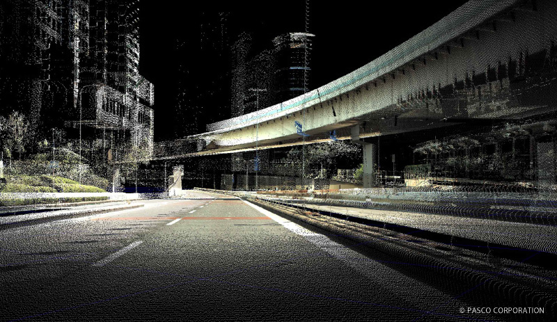
PASCO developed road condition measurement system (Real) to acquire road data including damage status of pavement, location, shape of road facilities, and roadside conditions, and to build road management services combining geographical information and road images.
So we support various services related to road maintenance.
The service will be mainly in Japan, but please contact us if you are interested in this service.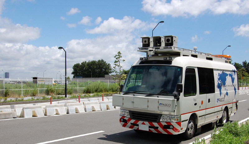
PASCO is a comprehensive company that acquires, processes and provides spatial information.
We offer spatial data such as topographic maps, GIS, satellite images, aerial photographs, etc., and support your spatial information analysis and corporate strategy planning.Real space was converted into 3D data by PASCO's spatial information technology.
The precise three-dimensional shape displays topographic features as building walls and rough slopes, etc. with free viewing angles on a computer screen.PASCO provides 3D topographic data of the whole world created from images taken by earth observation satellites.
This 3D topography data is used in a wide range of fields, including urban development, infrastructure planning, and disaster prevention.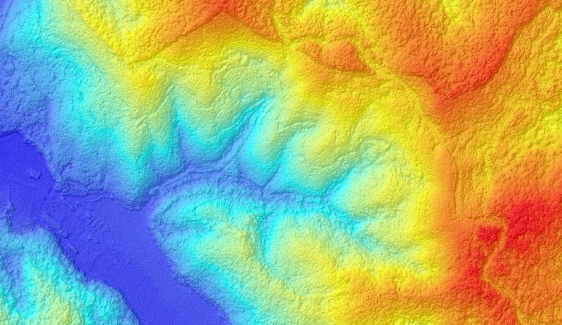
We provide spatial information solutions that meet the needs of companies, such as vehicle operation and allocation management systems that can be used in the field of logistics, and area marketing / strategy planning solutions that can be used in various industries.
The service will be mainly in Japan, but please contact us if you are interested in this service.PASCO develops and provides map solutions by utilizing spatial information in the logistics field.
Especially in using trucks and other vehicles, which are the core of land transportation, the logistics field has the issues of improving operation efficiency.
PASCO supports to solve problems such as cost reduction and operation efficiency improvement with allocation support system and mobile management system.Operation efficiency has become an issue in the logistics field.
PASCO supports logistics cost reduction and improvement of operation efficiency by "visualizing" the problems of allocation and delivery business with the allocation management solution "LogiSTAR allocation management".
Reducing the load of management for the vehicle operation is necessary in order to improve delivery quality.
Mobile management system "PLS (PASCO Location Service)" can realize delivery quality improvement without applying the operation load by judging the work progress from the location information of the vehicle.MarketPlanner* provided by PASCO has been used by many companies since its launch in 2003 as GIS(Geographic Information System) for area marketing(market area analysis and so on).
Users are not limited to retailer and service sector, but are used in a wide range of sectors, including manufacturers and financial institutions.
*Currently available in Japan.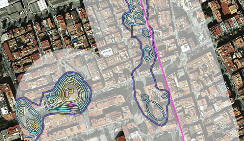
Land cover classification maps are automatically generated by applying AI technology to Synthetic Aperture Radar (SAR) satellites. Then, land cover change maps are generated by comparing the land cover classification maps of two different periods and extracting the change situation of the city.
Land cover classification to extract is divided roughly into "Artificial structure" "bare land" "water area" "grassland" "forest / tree". In addition to map expressing each situation, it is also possible to estimate the speed of urbanization and deforestation from the estimation of area and the change process of multiple time periods.